


Weekly Weather Watch: Sunday, April 7th, 2024
Your weekly weather heads-up email is coming Sunday because I need to warn folks about severe weather and the cloud situation for Monday’s eclipse. I just returned from Fort Worth, where I spoke to the Texas Banker’s Association (THANK YOU FOR HAVING ME!) and mentioned some active weather heading in their direction. The Southern Plains will have severe weather this week, others heavy rainfall, others dealing with wind and a cooldown; so let’s get to it.
For Sunday the 7th, Wet snow and strong wind will spread across the High Plains to the Northern Plains (Wyoming will see blizzard conditions continue throughout the day). Meanwhile, south of the snow, there’s a dangerous fire weather risk as strong wind hits the central and southern High Plains.
For Monday the 8th, the snowy system from the West moves through the Great Lakes with rain and snow, blocking the eclipse. Meanwhile, severe thunderstorms will deliver over the Southern Plains.
For the week, heavy rain, flash flooding, and severe thunderstorms continue across the southern U.S., and some heavy rain is possible over the East.
A series of systems will be moving through Alaska. The next strongest is likely to arrive by the weekend, when moisture will increase.
For Hawaii, the trades may weaken a bit momentarily, but look for a wind switch mid to late week, which will usher in lots of humidity and increase showers - particularly the western islands.
For Canada, colder-than-average temperatures will prevail in the West, and the East will be milder. Moisture, both rain and snow, will spread across the country, but the heaviest totals will come from the West, mostly the mountains—great water for runoff this spring. The Prairies will also experience some moisture.
In a nutshell, here are the threats:

We can watch the weather’s flow this week in this animation. This gives you the progression of showers/storms in six-hourly chunks.

With that in mind, how might these storm systems impact the Eclipse? Here’s an animation of Monday showing clouds and showers across N. America, with the eclipse path of totality also drawn.

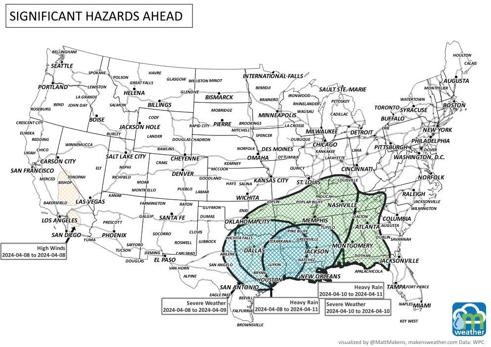
The action over the southern States will be most '“intense.” More specifically, regarding those risks of severe storms, we have the threat areas highlighted below for Monday and Tuesday. Stay weather-aware!


Okay, now, onto the total precipitation. You guessed it, the South is going to cash in with the heaviest totals.

Snowfall is widespread across Canada (okay, so not a ton, but at least it is something) and, to an extent, the northern States.

Although I may not need them, I will search for my eclipse glasses—darn clouds. Until next week, stay weather aware, and I leave you with those mentioned weather highlights for the week ahead. Blessings, Matt.