


Weekly Weather Watch: Monday, April 15th, 2024
Several items should be on your weather radar for this week. I won’t dilly. Here are the heads-up events to watch for during the week.
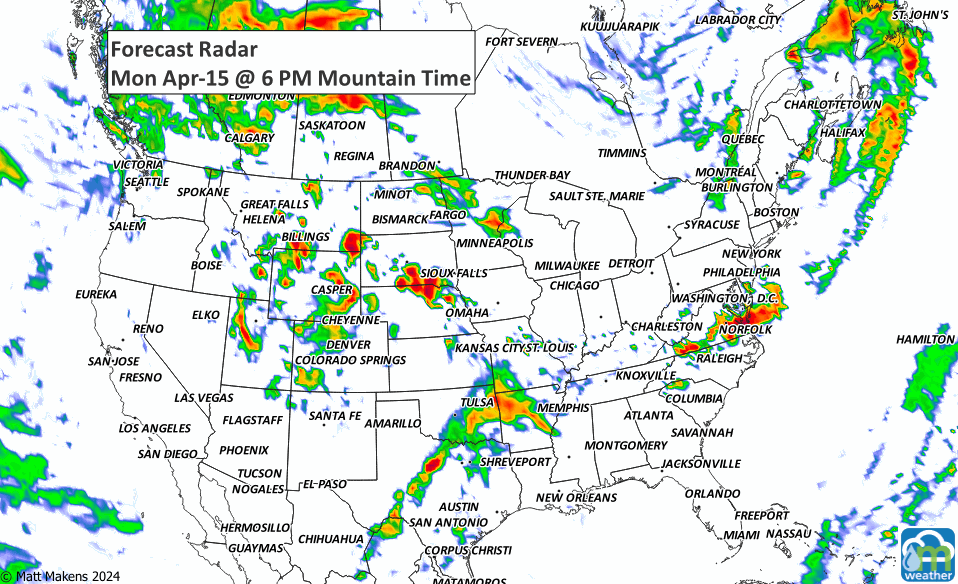
Severe weather and isolated flash flooding to the Plains on Monday, then the Mississippi Valley on Tuesday. There is a threat of some severe weather from the Upper Ohio Valley east through the Mid-Atlantic on Monday. (Outlook maps below)
Heavy snowfall is expected over the next couple of days for higher elevations of the northern Cascades, northern/central Rockies, and eastern Great Basin (Snowfall maps below)
Dangerous fire conditions for the High Plains Monday due to strong winds.
In Alaska, coastal rain and mountain snow ramp up later this week with a low offshore.
In Hawaii, the current system exits, and a normal trade regime with typical windward showers to set up later this week.
In Canada, a quick change to hit AB and the Prairies on Monday with a cold front’s arrival. A long period of snowfall with total amounts of 10 to 20 cm is expected. Heavy snow will begin this evening and taper off by Wednesday morning for most areas. Localities near the American border will see snow intensify on Tuesday. (Snowfall maps below)
Overall, a cooler pattern sets in, more unstable too.