


Weekly Weather Watch: Wednesday, April 24th, 2024
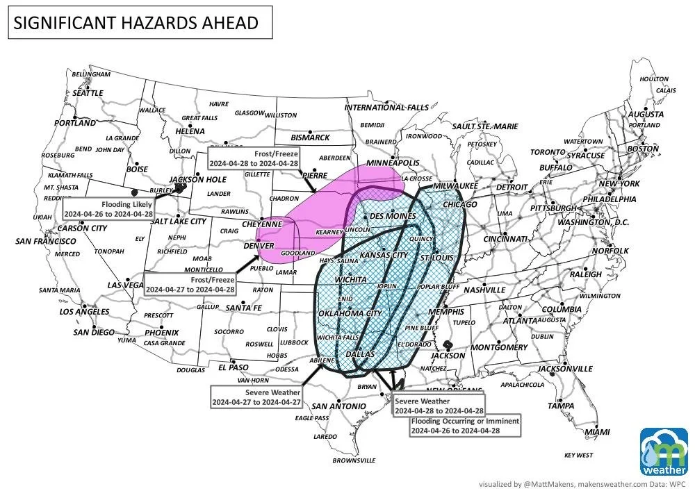
Here are the weather headlines for the situation in the days to come. First and foremost, severe thunderstorms with very heavy rainfall - along with tornado, hail, and wind threats, are expected across the Central U.S. through the next three days. Although valuable, the water may come a bit too much too fast in some cases; isolated flooding a concern. The bullet point list of things for your “radar” are below, first I need to thank the folks in the Texas Panhandle who graciously heard my bad news about an impending drought with La Niña’s return. So, Hemphill County - thank you for opening up your homes so graciously to me, and I hope to be invited back despite being the messenger with an outlook you did not want to hear.
Onto the list of items to be aware of this week:
Thunderstorms, potentially damaging, will spread across the central states this week along with heavy rainfall and areas of flooding.
A frost/freeze is possible across the Central to Northern Plains this weekend.
Fire weather an issue with strong wind across the High Plains, especially across New Mexico.
Eastern Canada can expect a rapid drop in temperatures today, meanwhile the mountains will continue to see a favorable storm flow with snowfall - a good late season boost to snowpack here.
Precipitation hazards will appear again in the eight to fourteen day range, more on that in the next Weekly Weather Watch email.

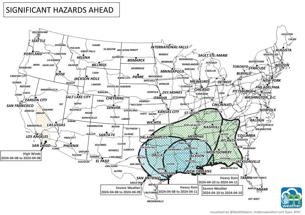
With the focus being on the severe weather this week, let’s look at the three days and the threat areas for damaging thunderstorms.


Here is a more specific timeline of storm activity across much of North America through the next ten days.

Total precipitation will favor the Central U.S. as well as the Pacific Northwest. Totals in these favored areas will surpass four inches.


Although there is a risk of frost/freeze this weekend, that colder weather doesn’t bring much by way of snow chances to the lower elevations; mostly confined to the mountains of the West where some snowfall totals will surpass two feet.


I hope this weather briefing brings you up to speed on what may be headed your way. Again, these are meant to be brief, please reach out if you need some assistance and I always recommend going to the National Weather Service before recommending any phone app to stay ahead of the storm.