Weekly Weather Watch: Tuesday, August 13th, 2024
A wet pattern hits the Southwest/West and Midwest toward New England. Meanwhile, drought grows for parts of the Southern Plains, and a tropical storm nears the U.S. This week’s weather briefing has arrived. MONTHLY MEMBERS, your supplemental weekly outlooks should have been delivered to your inbox yesterday.
HEADLINERS:
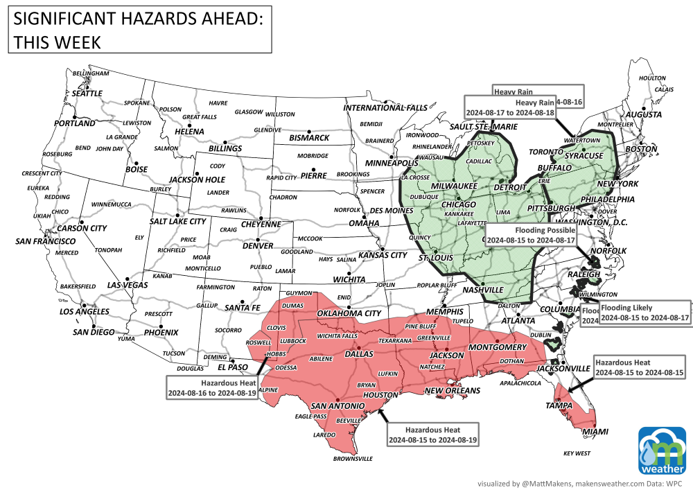
Dangerous heat is possible across the southern Plains and central Gulf Coast states now through this weekend and into next week.
Heavy rain hits the West through August 15th.
Heavy rainfall for the Midwest, Ohio Valley, and Mid-Atlantic the 15th to 18th.
From the 21st to the 23rd, portions of the Southeast, Lower Mississippi Valley, and Southern Plains are at a moderate risk of dangerous heat.
From the 21st to the 27th, portions of the Southern Plains, Lower Mississippi, Tennessee Valleys, and Southeast are at slight risk of dangerous heat.
Throughout, a rapid onset drought risk for portions of the Southern Plains and Lower Mississippi Valley.
ON THE RADAR:
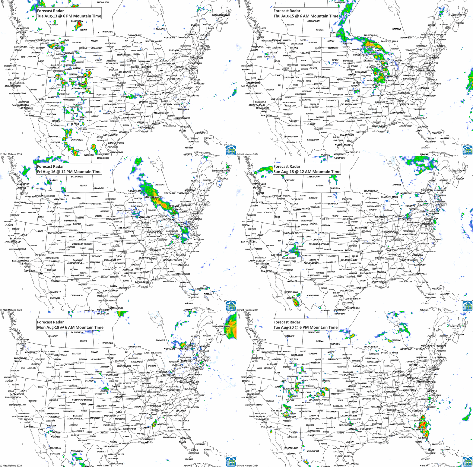
The storm timeline, and then the risks for damaging storms during the next three days.
IN THE GAUGES:
Colorado folks, your forecast was just sent out on Weather5280.com. Here are the estimated rainfall totals for the week. This is the most probable total IF IF IF you get the thunderstorms…
RECORDS MADE TO BE BROKEN:
Heat is focused on the South, mainly Texas.
TROPICAL TIDINGS:
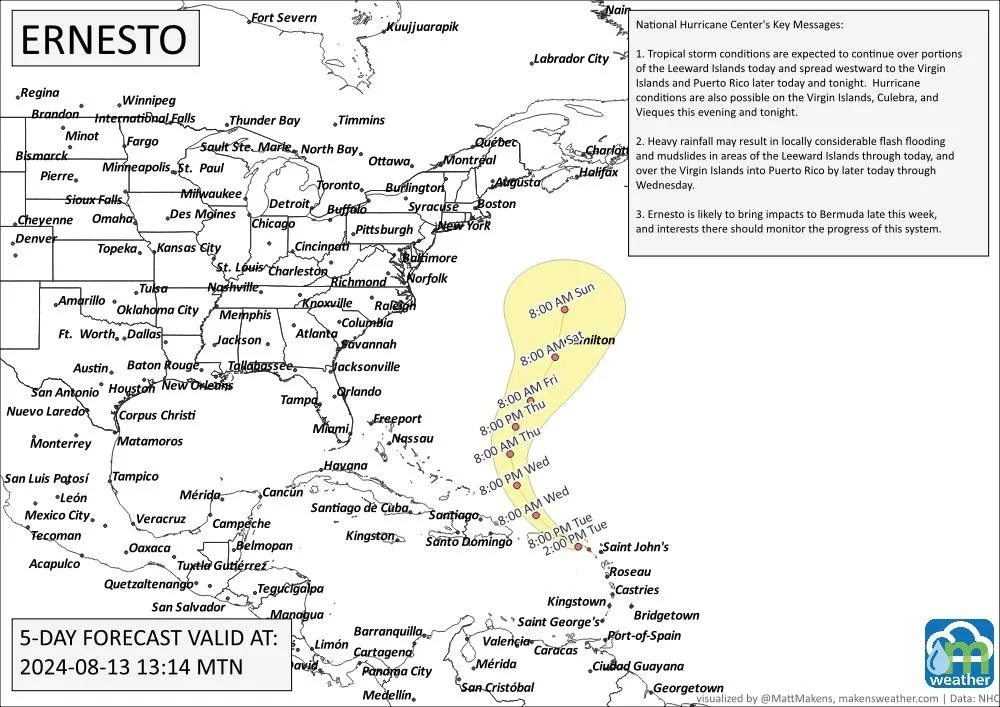
Ernesto is impacting some of the islands, and is expected to stay east of the mainland.
ARE YOU CIRRUS?
Tornado damage reported above 10,000 feet?! You betcha, just happened to cause EF1 damage, too. Full story via AccuWeather. And, why is the U.S. the hotbed for tornadoes? This researcher aims to find out.


