


Weekly Weather Watch: Monday, July 29th, 2024
As we draw to a close on July, you can guess where August is headed… a hot and smoky start for the majority of us. In this week’s weather brief, be on the watch for wildfire smoke, record-setting temperatures, a couple areas of super heavy rainfall, in part along a cold front that’ll drive across the northern states this week and may also increase risks of severe thunderstorms. Let’s get to it.
HEADLINERS:
Flash flooding is possible in the Ohio/Tennessee Valleys and central/southern Appalachians early this week.
Scattered severe thunderstorms and heavy rain are forecast across portions of the Northern Plains and Midwest.
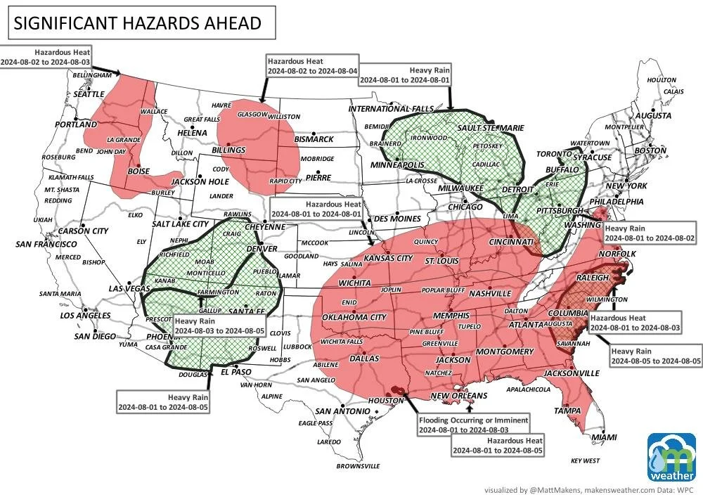
Dangerous mid-summer heat wave to expand across the Central U.S. and Southeast.
Heat, and smoke the biggest issue across Canada, although a few areas of severe weather are also expected - especially northern Alberta and Saskatchewan today and tomorrow.
There is a high risk of excessive heat for parts of the northern intermountain, northern Great Basin, Rockies, and northern and central high plains from Saturday to Monday, August 3-5.
There is a moderate risk of excessive heat for parts of California, the Pacific Northwest, the Great Basin, the Rockies, and the Great Plains from Saturday through Friday, August 3-9.
Moderate risk of excessive heat for the Northeast, eastern Great Lakes, Central Appalachians, and Mid-Atlantic region, Sat-Wed, Aug 3-7.
There is a slight risk of excessive heat for much of the CONUS, except for parts of the Southern Plains, Lower Mississippi and Tennessee Valleys, Southern Appalachians, and Southeast, Sat-Fri, Aug 3-9.
There is a slight risk of heavy precipitation for parts of the Desert Southwest, Sat-Wed, Aug 3-7.
There is a slight risk of heavy precipitation for parts of the Southeast and Lower Mississippi Valley, Sat-Tue, Aug 3-6.
Slight risk of high winds for much of the western CONUS and High Plains, Sat-Wed, Aug 3-7
There is a slight risk of high winds for parts of the Southeast and Lower Mississippi Valley, Sat-Wed, Aug 3-7.
Rapid Onset Drought risk for much of the Great Plains and into western Missouri.
-Source: WPC
ON THE RADAR:
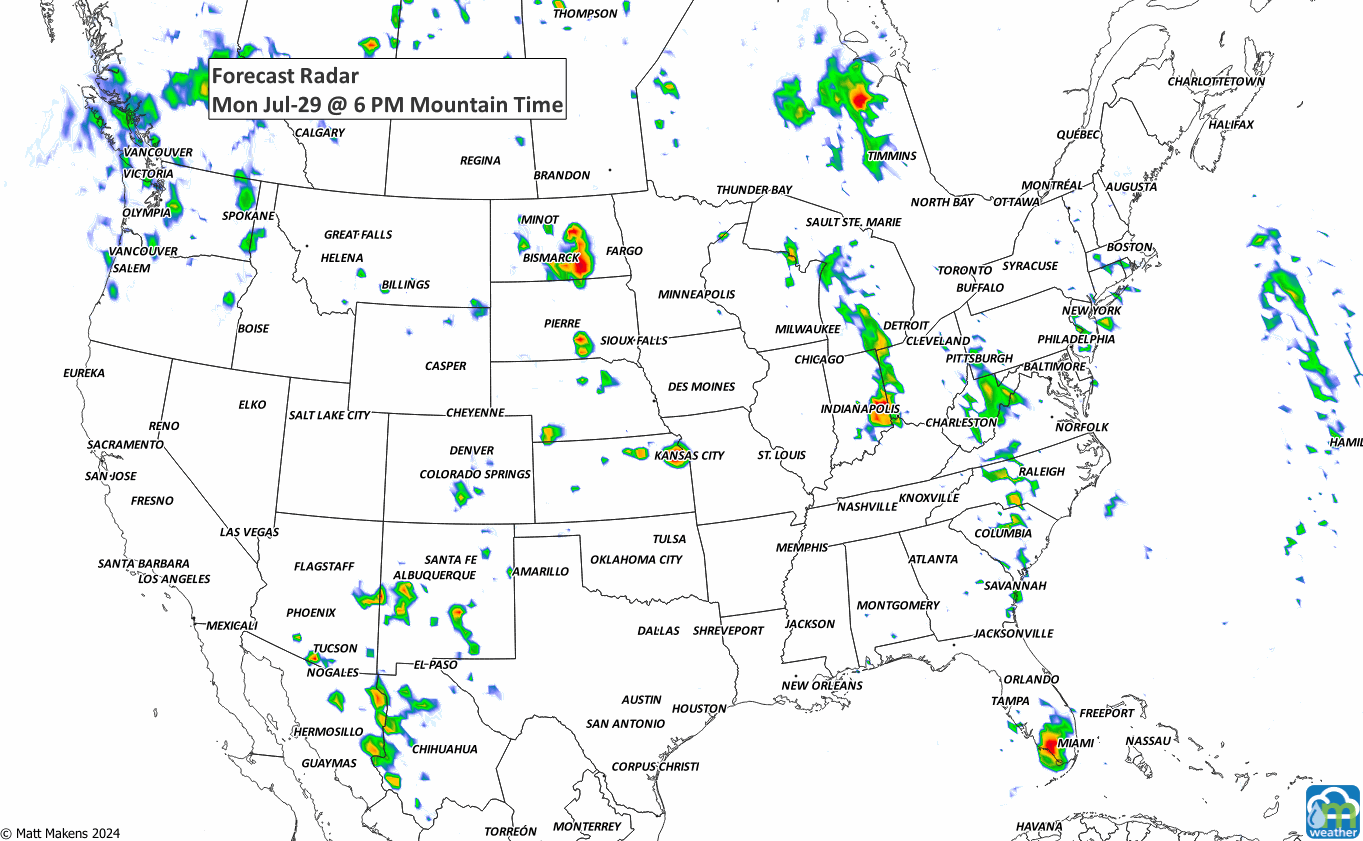
There will be increased chances for damaging/severe thunderstorms this week. For example, Monday and Tuesday’s outlooks are as follows.


IN THE GAUGES:
The Canadian Prairies and the Central to Southern Plains are mostly dry this week. There is a bit of monsoonal flow to produce rainfall in Mexico into the Four Corners Region, a bit of moisture for the Northern Rockies, but most of the water is along/east of the Mississippi River.


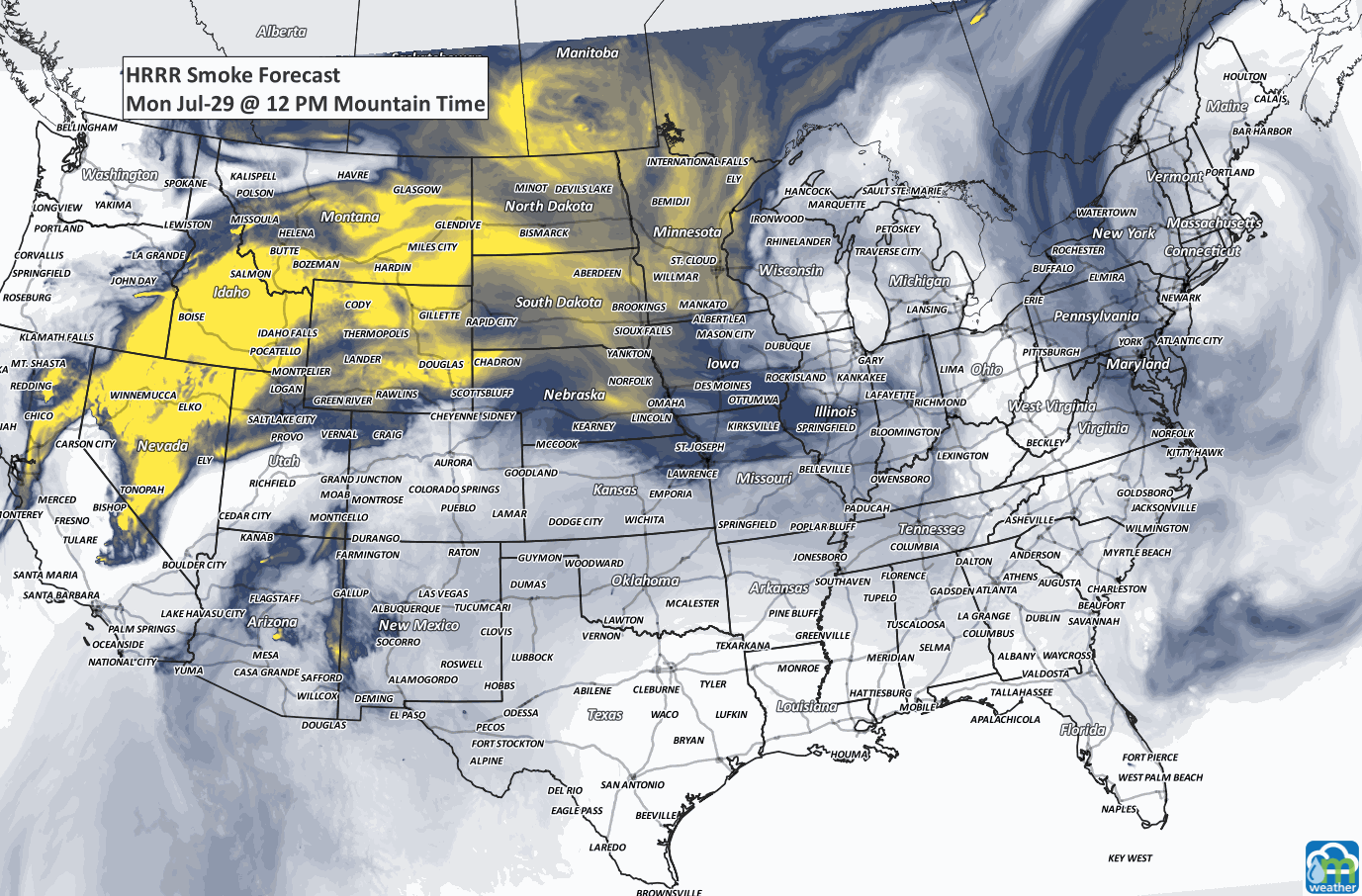
SMOKY BANDIT:
RECORDS MADE TO BE BROKEN:

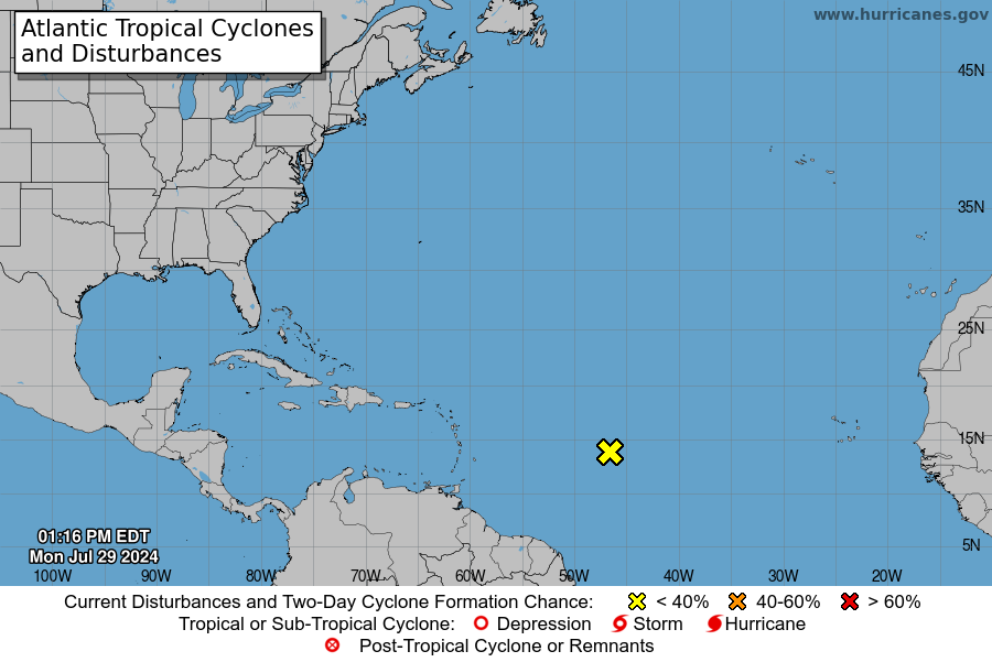
TROPICAL TIDINGS:
There’s a disturbance in the Atlantic that is capable of developing into a tropical system later this week. The probability for such development between now and Wednesday is quite low, however.
ARE YOU CIRRUS:
Notable July 28th events…
1945 A B-25 bomber crashed into the 79th floor of the Empire State Building due to fog, killing 14 people and causing $1 million in damage
1997 Fort Collins, Colorado was hit by a flood that killed five people and led to the creation of CoCoRaHS, a network of volunteers who monitor rainfall