Weekly Weather Watch: Wednesday, November 13th, 2024
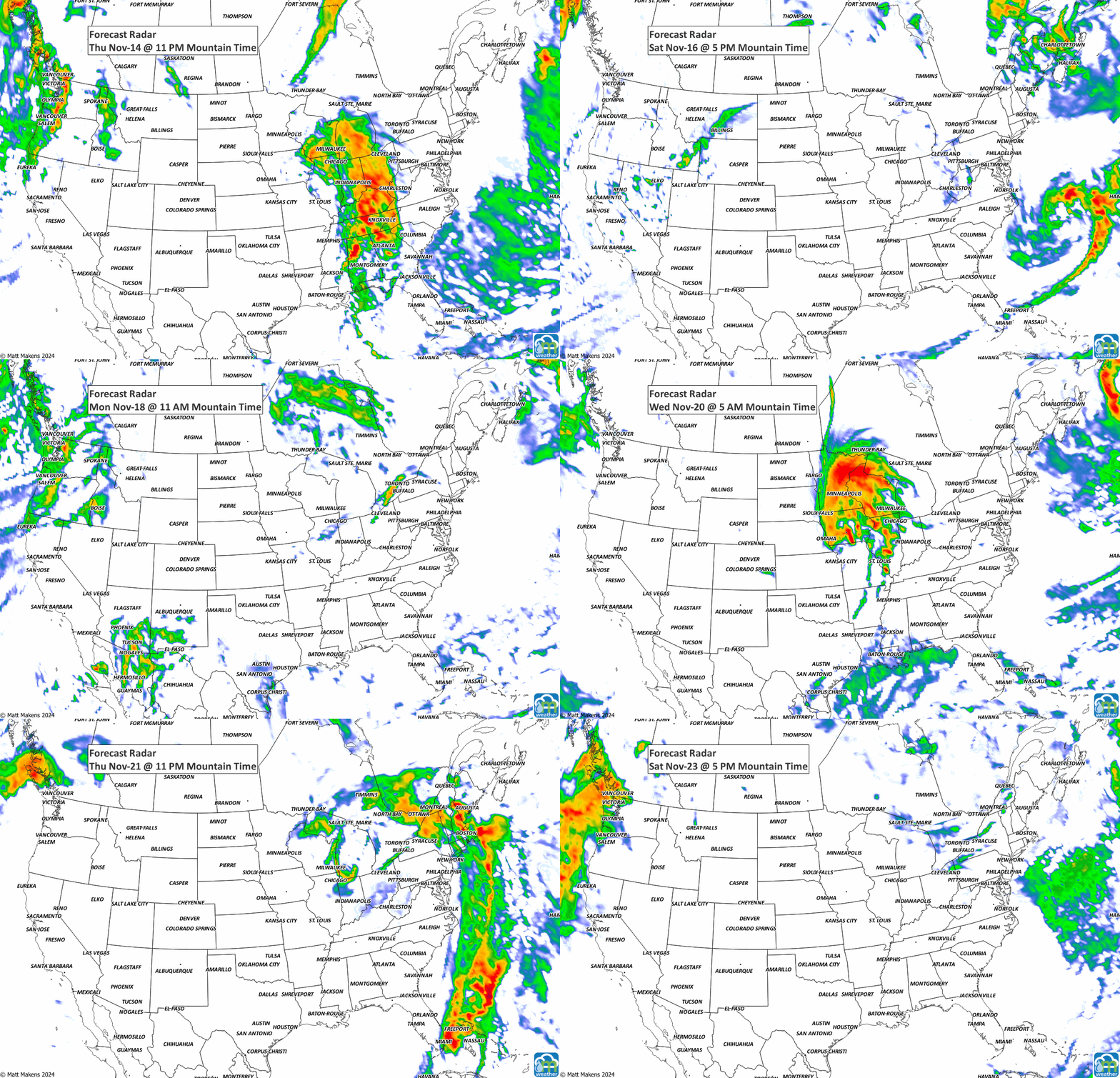
An Atmospheric River is set to bring heavy rain to the coast and mountain snow to the Pacific Northwest and Northern California on Wednesday. Meanwhile, showers and thunderstorms will roll through the Lower Ohio, Tennessee, and Mississippi Valleys, bringing some heavy rain. There’s a chance of scattered flash flooding, especially in Louisiana and Mississippi. Across the central U.S. and Gulf Coast, temperatures will stay above average, while the Northeast and the West will see cooler air moving in.
HEADLINERS:
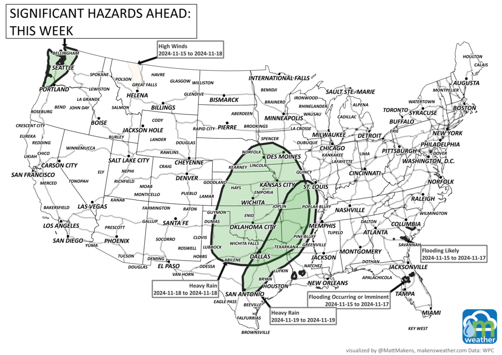
Heavy rainfall for the Pacific Northwest this week, mainly the 17th.
Heavy precipitation for British Columbia. Rain and wind for Newfoundland and Labrador.
Heavy rainfall for parts of the Central Plains to Delta Region for the 18th and 19th.
Moderate risk of much below-normal temperatures for portions of central Oklahoma, and western, central, and northern Texas, Wed-Thu, Nov 20-21.
Slight risk of much below-normal temperatures for much of the Southern Plains, Wed-Fri, Nov 20-22.
Slight risk of heavy snow for portions of the Central and Northern Plains and along the Front Range of the Rockies, Wed-Fri, Nov 20-22.
Moderate risk for high winds for portions of the Central and Northern Plains, Wed-Fri, Nov 20-22.
Slight risk of high winds for much of the Great Plains, Middle and Upper Mississippi Valley, and Great Lakes, Wed-Fri, Nov 20-22.
Slight risk of high winds for coastal portions of southern California, Wed-Thu, Nov 20-21.
Slight risk of heavy precipitation for the Florida Peninsula, Wed-Fri, Nov 20-22.
ON THE RADAR:
IN THE GAUGES:
GRAB A RULER:
RECORDS MADE TO BE BROKEN:
TROPICAL TIDINGS:
A broad area of low pressure over the central Caribbean Sea continues to produce a large area of showers and thunderstorms. Environmental conditions are conducive for development, and a tropical depression is likely to form within the next couple of days while the system moves slowly westward into the western Caribbean Sea. Afterward, further development is likely while the disturbance meanders over the western Caribbean Sea through the weekend. The system is expected to turn slowly northwestward by early next week. Interests across the western and northwestern Caribbean Sea should monitor the progress of this system. Regardless of development, heavy rains are expected over Jamaica during the next day or so. For more information on this system, including gale warnings, see High Seas Forecasts issued by the National Weather Service. An Air Force Hurricane Hunter aircraft is scheduled to investigate this system later today. - NHC
ARE YOU CIRRUS?!
Last week’s snow for Colorado was one for the record books. Read more now at Weather5280.
SHOUTOUT!!!
A thank you to Agriculture AgriFood Canada and the Maritime Beef Council for having me speak at their conference this past weekend in Moncton, NB, Canada with stops in Toronto, Halifax, and New York along the way. We discussed sustainability, particularly with drought, for cattle producers across the Maritimes, Canada, and North America. It was a great trip and glad to make new connections and catch up with existing ones.


