Weekly Weather Watch: Monday, January 8th, 2024
Prepare for COLD! While the country deals with heavy precipitation now and during the next ten days, including notable snowfall in many states, we will soon hit the deep freeze. The most substantial cold of the season will move in and hit most of the country with below-normal temperatures, in some cases dangerously cold. Just as an example, here are the estimated low temperatures for Sunday. This does not consider any wind, so those with that will have substantially colder windchill.
As I prepared Monthly Members in their January weather outlook sent out on the 1st, the middle two weeks of January have quite the wintry pattern.
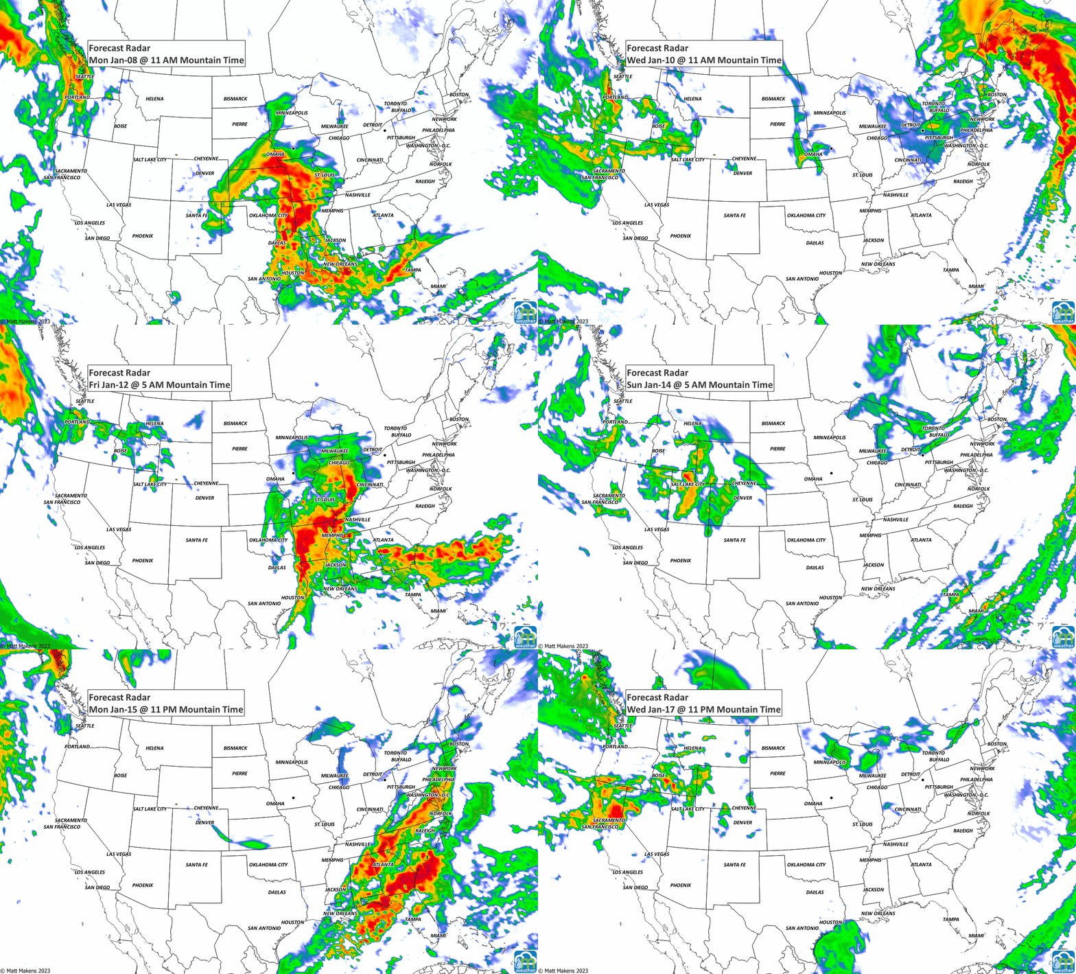
Welcome to the Weekly Weather Watch, your briefing on the weather headlines created during the week ahead. This cold is coming through via a storm track that will make a series of storm systems crossing the country. You’ll hear about significant snows, rains, and the travel nightmares to go with that. Here’s an animation showing the “action” during the week.
That animation shows three distinct systems crossing the country, with the potential for a Nor’easter next week. With these systems comes a lot of moisture. First, the total precipitation is shown; check out that water for the Northwest and along the Eastern Seaboard!
Now, part of that moisture shown above will come as snowfall (ice, too), but just the snow potential is shown here. Folks from Iowa to Michigan who want things to look like winter will get their wish with potential totals like this. Plus, the lackluster snowpack in the mountains continues to increase in the next week/week plus.
Elsewhere, Hawaii may have areas of flooding as a couple of low-pressure areas impact the Islands. And, Alaska has stormy conditions for the Aleutians and the west.
It’ll be quite a period of active weather. Sadly, there will be a lot of monetary losses to the Ag Industry, supply chains, and travelers, etc. Be safe, and be well. - Matt.


